A helicopter flying over the Great Salt Lake last winter was looking for something that should have been hard to find: fresh water hiding under one of the saltiest places in the American West.
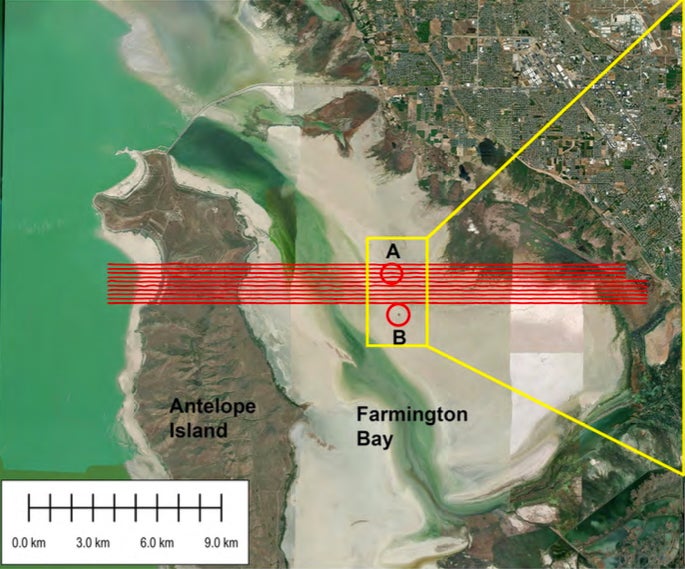
What turned up was a sharper picture of an underground system that may be far larger than scientists once thought. Using airborne electromagnetic surveys over Farmington Bay and part of Antelope Island, University of Utah researchers found signs that freshwater-saturated sediments lie beneath the lake’s hypersaline surface and may extend down 3 to 4 kilometers, or roughly 10,000 to 13,000 feet.
That does not mean a giant new water supply is ready to be tapped. But it does suggest the eastern margin of the Great Salt Lake holds a deep and surprisingly extensive freshwater zone beneath a thin saline layer, a finding that could matter for dust control, water planning, and future lake-wide surveys.
The work appears in Scientific Reports and is part of a broader state-funded effort led by the University of Utah’s Department of Geology & Geophysics to understand groundwater beneath the Great Salt Lake, the largest terminal lake in the Western Hemisphere.
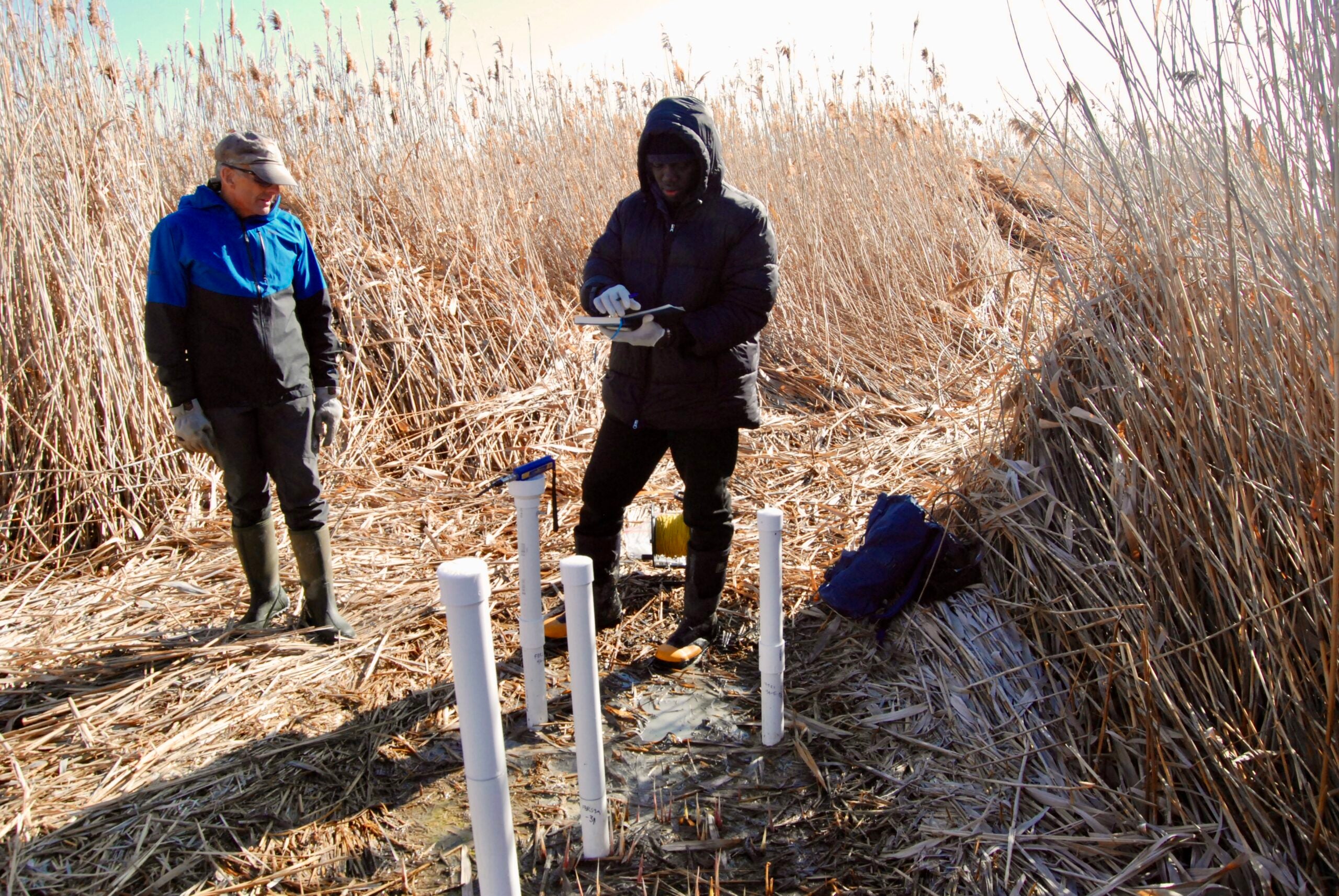
The project grew out of a strange sight on the exposed floor of Farmington Bay. As the lake declined, circular mounds appeared across the dried playa, each about 50 to 100 meters wide and covered in phragmites, tall invasive reeds that can reach 15 feet. Researchers had already documented freshwater welling up under pressure at some of those spots.
That raised a basic question. How far does that freshwater go?
Lead author Michael Zhdanov, a distinguished professor of geology and geophysics and director of the Consortium for Electromagnetic Modeling and Inversion, said the new survey helped answer that. “We were able to answer the question of how deep is this potential reservoir, and what is its spatial extent beneath the eastern lake margin. If you know how deep, you know how wide, you know the porous space, you can calculate the potential freshwater volume.”
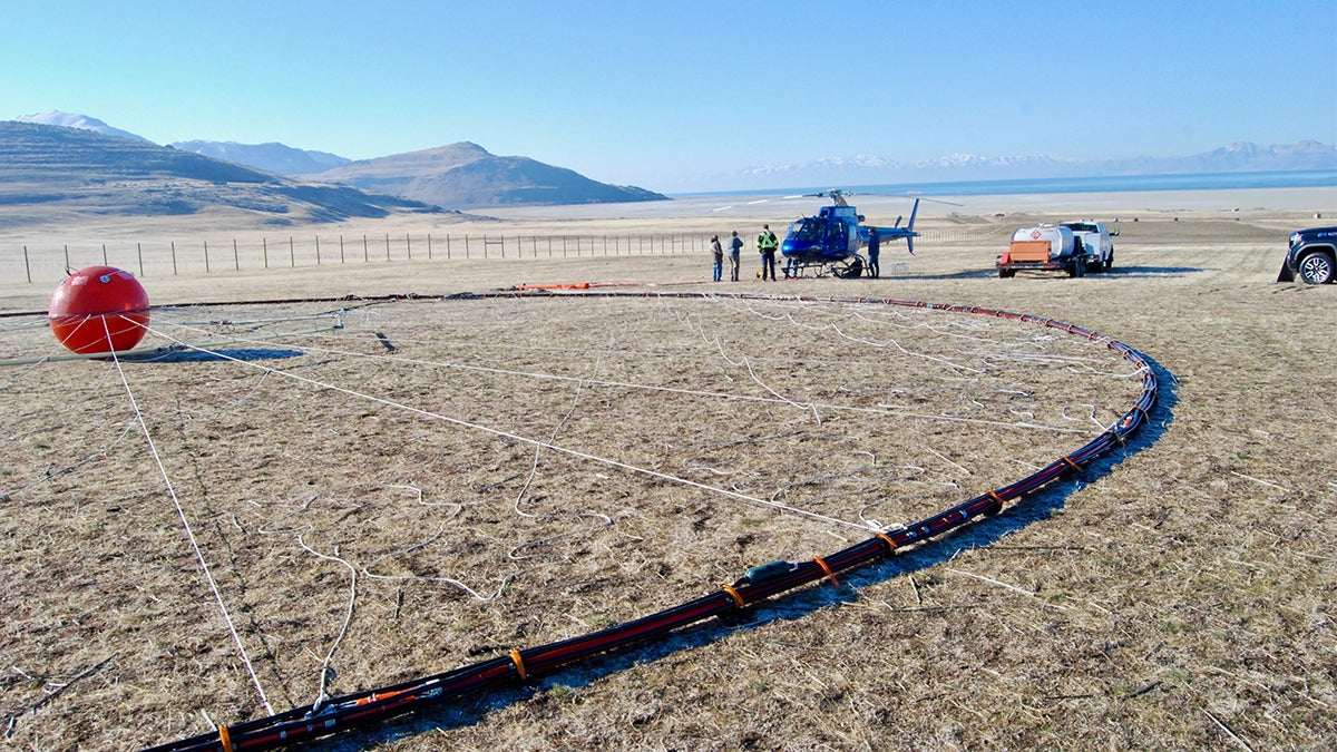
To look below the surface, the team hired a Canadian geophysical crew to fly electromagnetic equipment beneath a helicopter in February 2025. The aircraft covered 10 east-west survey lines across Farmington Bay and the northern part of Antelope Island, totaling 154 miles, or 248 line kilometers.
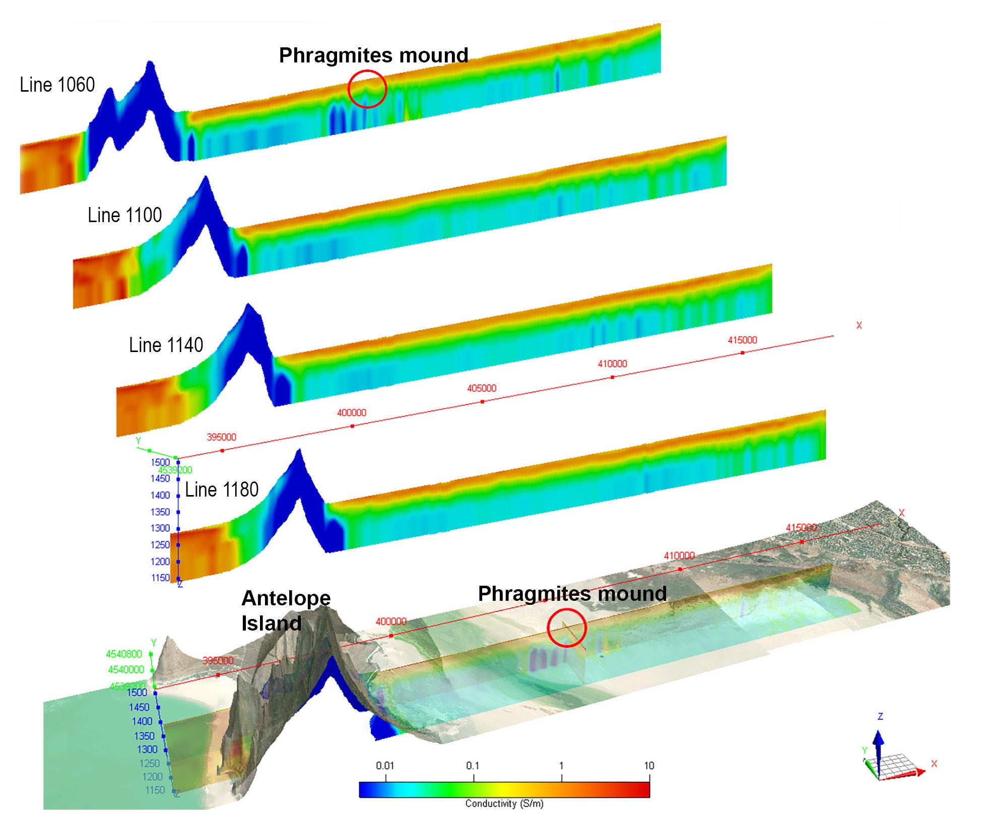
The method measured electrical resistivity to depths of about 100 meters. Because brine is far more electrically conductive than freshwater, the contrast allowed the researchers to map the boundary between the two. Their 3D inversion model showed a laterally continuous saline layer near the surface, about 10 to 15 meters thick on average, overlying a more resistive zone interpreted as freshwater-saturated sediments.
The survey also picked up one of the phragmites mounds in detail. In that spot, the saline layer thinned and freshwater appeared to push upward through it. Zhdanov put it simply while describing the map: “Red means very conductive, blue is resistive. You clearly see near surface is saline water, 10 meters underneath is resistive freshwater. You see clearly it’s everywhere.”
Hydrologist Bill Johnson, a co-author on the Great Salt Lake groundwater papers, said the surprising part was not the salty lens near the surface. It was what lay beneath it.
“The unexpected part of this wasn’t the salt lens that we see near the surface across the playa. It’s that the freshwater underneath it extends so far in towards the interior of the lake and possibly under the entire lake. We don’t know,” Johnson said on KPCW’s Cool Science Radio show.
That uncertainty matters. The pilot survey covered only a sliver of the Great Salt Lake’s 1,500-square-mile footprint. The airborne electromagnetic data could resolve conditions to about 100 meters deep, but the estimate that freshwater-saturated sediments may reach 3 to 4 kilometers came from magnetic inversion used to map the basin’s basement structure. That deeper interpretation still needs more hydrological confirmation.
The magnetic data suggested that the basement under Farmington Bay is shallow, less than 200 meters down in some places, before dropping sharply to more than 3 kilometers. That steep boundary may help define where deep groundwater can move.
Johnson is especially interested in what this could mean for a different crisis. Falling lake levels have exposed about 800 square miles of playa, and that dry lakebed is becoming a growing source of dust pollution blowing toward Utah population centers. Some of that dust contains toxic metals.
“There are beneficial effects of this groundwater that we need to understand before we go extracting more of it. A first-order objective is to understand whether we could use this freshwater to wet dust hotspots and douse them in a meaningful way without perturbing the freshwater system too much,” Johnson said.
The researchers say the study marks the first time airborne electromagnetic methods have been used to detect freshwater beneath the Great Salt Lake’s thin but highly conductive surface brine. It also showed that combining those data with magnetic measurements can build a fuller picture of what lies below.
Still, the authors are careful not to oversell the result. Resistive zones in the subsurface are not always caused by freshwater. They can also reflect lithologic changes, cementation, or even gas and oil. In this case, the freshwater interpretation is supported by earlier direct measurements from sediment cores and piezometers, but the new airborne work mainly maps its lateral extent and possible structural setting.
The most immediate value of the study is not a new water source ready for development. It is a better map of where freshwater may sit beneath a drying, dust-prone lakebed.
That could help Utah scientists judge whether groundwater can be used to wet dust hotspots without damaging the broader system.
It could also guide future lake-wide surveys and help researchers look for similar freshwater reserves beneath terminal lakes elsewhere in the world.
Research findings are available online in the journal Scientific Reports.
The original story “Scientists discover freshwater hidden beneath Utah’s Great Salt Lake” is published in The Brighter Side of News.
Like these kind of feel good stories? Get The Brighter Side of News’ newsletter.
The post Scientists discover freshwater hidden beneath Utah’s Great Salt Lake appeared first on The Brighter Side of News.